Schoonebeek → About 1830 the first complete cadastre of the Netherlands was made by surveyors. This cadastre contained even plot-limits and the buildings on them. The owners …
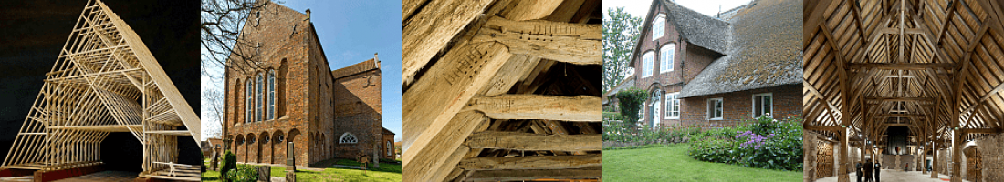
Ostfrieslands Kirchen → The cultural landscape of the East Frisian peninsula is characterized by a variety of impressive high and late medieval village churches, especially in the …
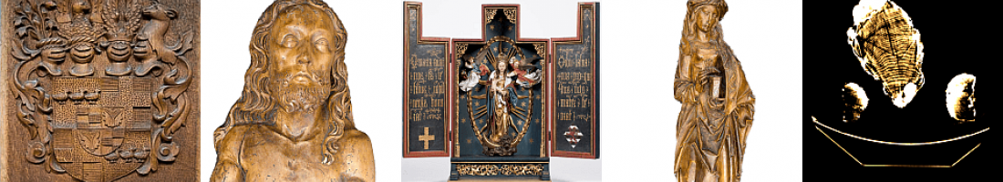
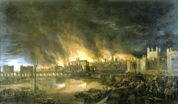
Denbosch → Fires often mean caesuras to a cities building history. During the 15th century two big town fires happened in ‘s-Hertogenbosch in a short interval of time, in …
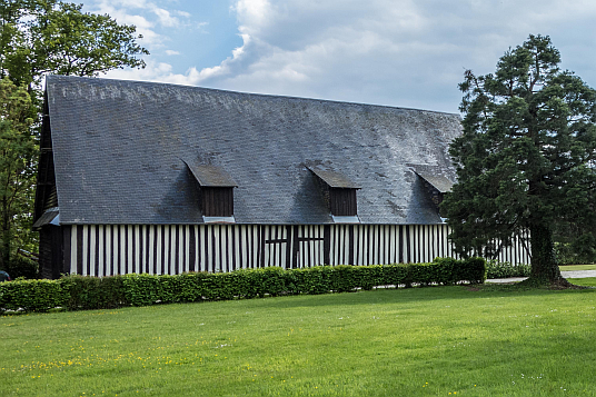
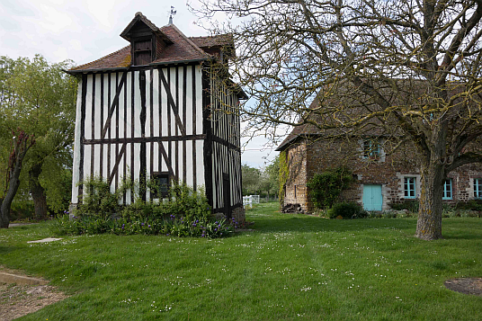
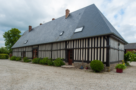
Normandie → It is little known that, apart from the big monastic granges, there were granges similar in size and shape built on farms of the aristocracy in France and in …
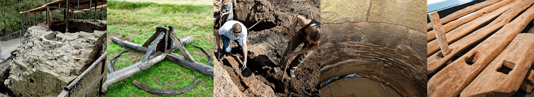
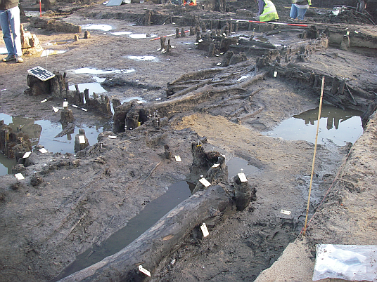
Terborg → In 2010 the Archeodienst Gelderland conducted an archaeological excavation of a settlement area in the historic town centre of Terborg, a city situated in the …
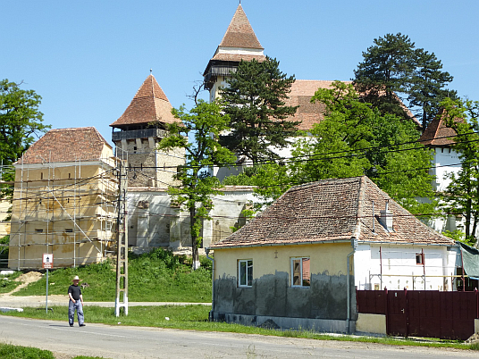
Rumänien → Romania has become part of the EC a few years ago and thus moved closer to the center of Europe. Therefore it is no wonder that the number of reports about the …
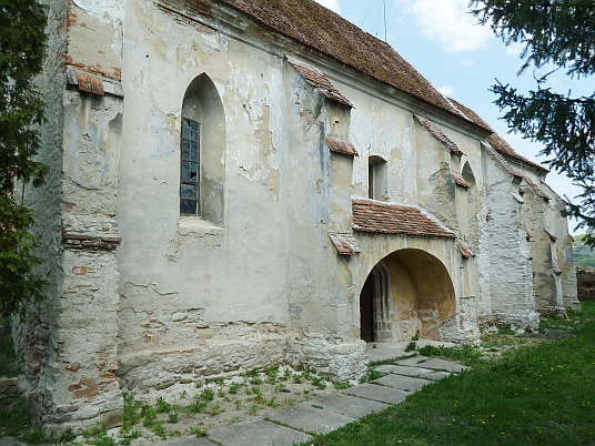
Rumänien Viscri → Objekt 6862: RO, Viscri (Deutsch Weißkirch), Kirchenburg - Westturm Objekt-Koordinaten: 46,054°N; 25,088°O
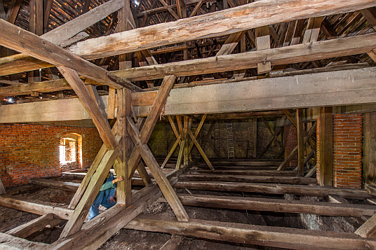
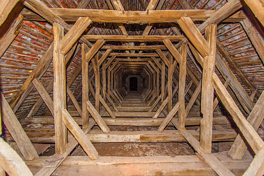
Rumänien Biertan → Objekt 6860 und 6630: RO, Biertan (Birthälm), Kirchenburg - Chordachwerk Objekt-Koordinaten: 46,135°N; 24,521°O
Rumänien Cisnadie → Objekt 6854: RO, Cisnadie (Heltau), Kirchenburg - Westturm Objekt-Koordinaten: 45,712°N; 24,150°O
Rumänien Trappold → Objekt 6861: RO, Apold (Trappold), Kirchenburg - Speckturm Objekt-Koordinaten: 46,125°N; 24,818°O
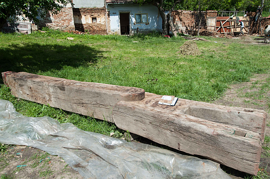
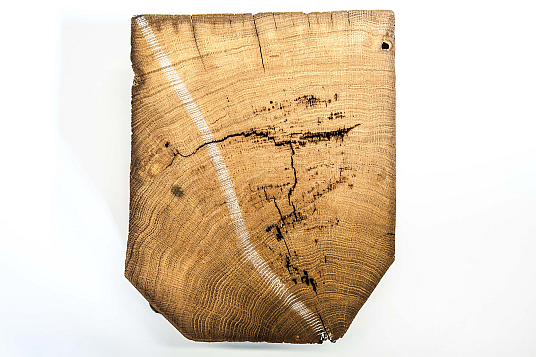
Rumänien Richis → Objekt 6851: RO, Richis (Reichesdorf), Weinkelter Objekt-Koordinaten: 45,932°N; 24,460°O Inschriftliche Datierung: 1813 HL
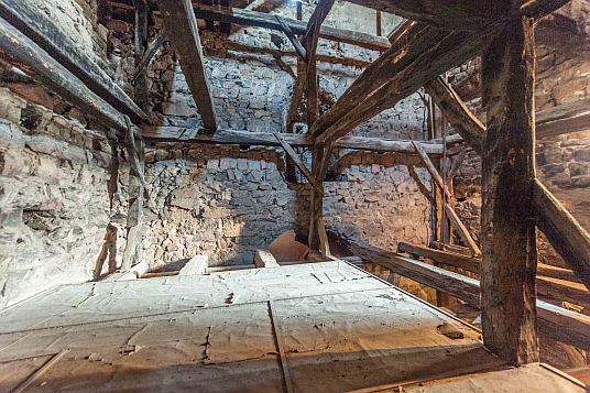
Rumänien Altana → Objekt 6850: RO, Altana (Alzen), Kirchenburg - Langhausdach Objekt-Koordinaten: 45,929°N; 24,459°O
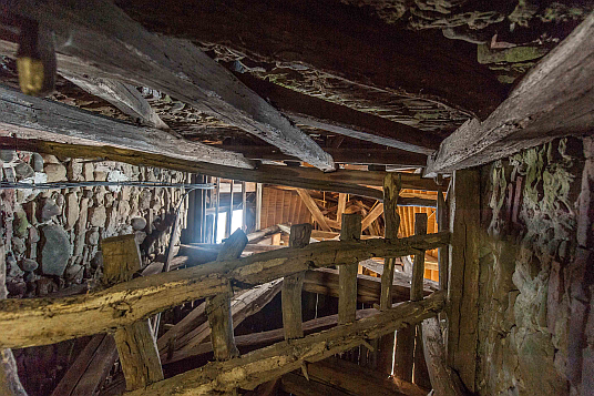
Rumänien Hosman → Objekt 6849: RO, Hosman (Holzmengen), Kirchenburg - Wagenschauer Objekt-Koordinaten: 45,831°N; 24,425°O
Rumänien Sanvasii → Objekt 6864: RO, Sanvasii (Gallendorf) Kirchenburg - Glockenturm Objekt-Koordinaten: 46,499°N; 24,740°O
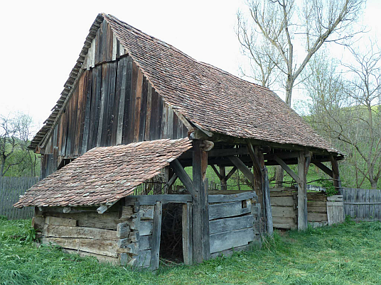
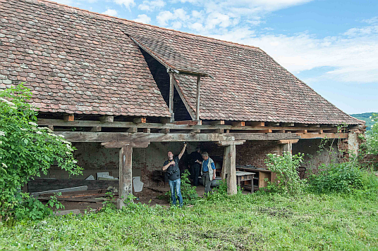
Rumänien Roades → Objekt 6624: RO, Roades (Radeln) Haus Nr. 41, Scheune Objekt-Koordinaten: 46,128°N; 25,110°O
Rumänien Moardas → Objekt 6629: RO, Moardas (Mardisch) Kirchenburg - Dachwerk der Kirche Objekt-Koordinaten: 46,009°N; 24,354°O Inschriftliche Datierung: Ano 1789 Die 25. May Zim …
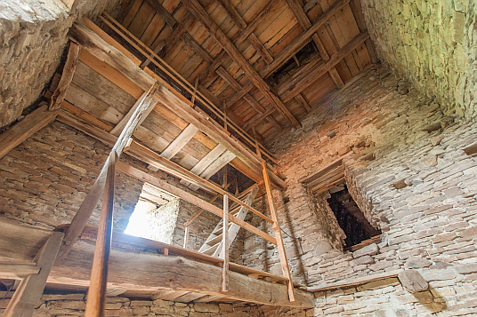
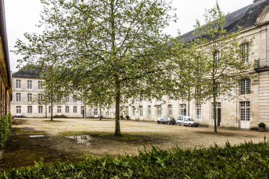
Bec-Helloin, Normandie → Objekt 7038B: FR, Abbaye Le Bec-Helloin Dachwerk über dem Refektorium Objekt-Koordinaten: N49° 13' 43" E0° 43' 19"
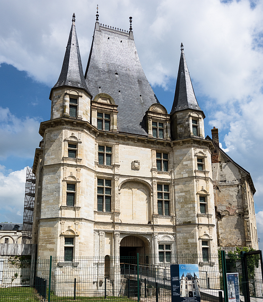
Gaillon, Normandie → Gaillon and its Chateau, situated about 40 km south of Rouen in Normandy, has been the place where 50 carpenters from all over the world met each other. In the …
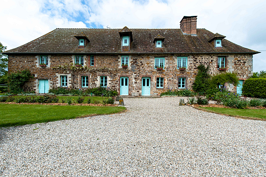
Gaillon, Normandie, La Roussiere → Object 7030B: FR, La Roussière, Manoir de La Haut Moine Coordinates: 48°57'19" N 0°33'53" E
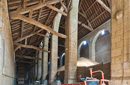
Gaillon, Normandie, La Roussiere, La Grange → Objekt 7028B: FR, La Roussiére, Manoir de La Haut Moine Scheune/ La Grange Objekt-Koordinaten: N49°9'37.38" E1°19'49.90"
Gaillon, Normandie, La Roussiere, Taubenturm → Objekt 7034B: FR, La Roussière, Manoir de La Haut Moine, Taubenturm Objekt-Koordinaten: 45,712°N; 24,150°O
Gaillon, Normandie, La Roussiere, Grange aux Diemes → Objekt 7029B: FR, La Roussiére, Manoir de La Haut Moine Grange aux Dimes Objekt-Koordinaten: N49°9'37.38" E1°19'49.90"
Gaillon, Normandie, Rue General de Gaulle → Objekt 7035B: FR, Gaillon, Rue Général de Gaulle, Wohnhaus Objekt-Koordinaten: N49°9'37.38" E1°19'49.90"